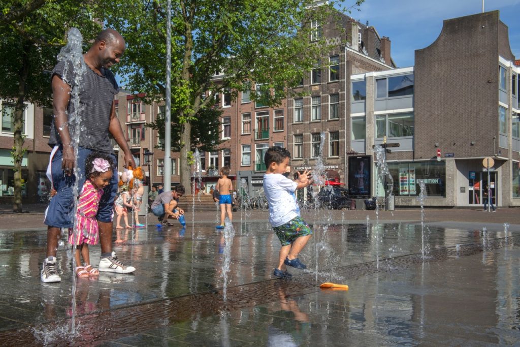
How do you keep a grip on spatial issues that are becoming increasingly complex? While making choices for the short and (very) long term. It starts with getting and keeping an optimal view of relevant aspects. Digital twins offer that view. These digital representations of the city make it possible to first test policy and solutions virtually and explore various scenarios. This allows you to reach well-considered decisions, limit risks and increase the input and support of residents and other stakeholders. At DMI, together with our participants, we make this technology widely accessible and applicable.
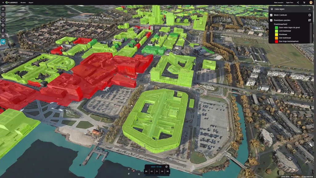
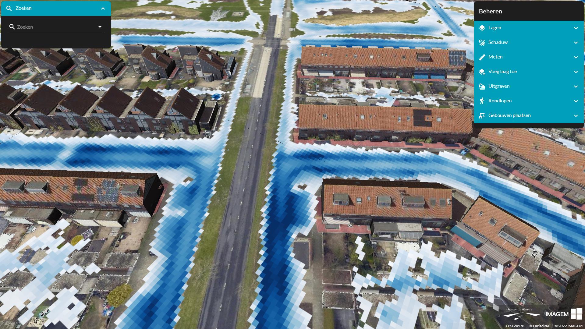
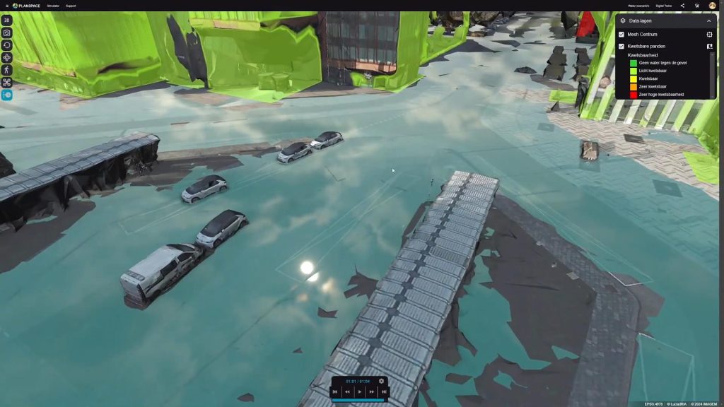
A digital twin is a virtual representation of reality. In our case, a digital copy of the physical environment, such as an area, building or infrastructure. This digital twin is fed with data, real-time or otherwise. Think of data on traffic flows, air quality, energy consumption, soil and subsoil and/or social dynamics. Combining that data in a digital environment creates a coherent picture and thus a very powerful tool for analysis, scenario development and decision-making on policy, design and investments. Interdependencies or effects become visible. And you can, for example, simulate the effect of a new residential area on mobility or how greening reduces heat stress.
From insight to impact
A digital twin makes it possible to test policies before they are implemented. Decisions are based on actual analyses and information, which helps to make better choices and to deploy resources more efficiently. But also to be able to look further ahead in time: what else is coming our way in this area and how do we deal with it effectively? At DMI, municipalities work together with companies and knowledge institutions on scalable applications of digital twins. Think of combining GIS data, or data from a geographic information system, with mobility models. Or linking sensor data on air quality, for example, to spatial plans. This creates a digital workshop for the city of today and tomorrow. Everyone works with the same information, reducing the risk of misunderstandings, failure costs and hassle afterwards.
Best practices
Broadly applicable approach
At DMI, we are continuously developing and applying digital twins. Public and private participants share their experiences, tools and datasets and join to explore, use and scale together. The goal is to arrive at a widely applicable approach that works for large and smaller cities and companies.
How to digital twin?
Where do you start with a digital twin? Many organizations struggle with that question. DMI is working on a how-to-digital twin method. This takes into account the NLDT principles (the Network of Local Digital Twins). It is a learning environment in which policy makers, planners or experts learn step-by-step how to deploy a digital twin. The method covers definitions, policy aspects, spatial planning, technology and organization. It is an interactive experience based on case histories and job profiles.
Call: bring in knowledge!
We call on participants to contribute knowledge from actual projects for the further development of the method. This will create a shared foundation of data, models and visualizations. Whether you are working on participation, area development, housing, mobility or climate adaptation: digital twins help to better involve stakeholders and explore scenarios. And that doesn't always have to be fancy 3D visual. Sometimes a mathematical model can suffice.
Digital representations of the city make it possible to first test policy and solutions virtually and explore various scenarios. This allows you to reach well-considered decisions, limit risks and increase support from residents and stakeholders. At DMI, we make this technology widely applicable and scalable.
MOBILITY
Within the DMI ecosystem, we work together on digital insight into mobility. It's about being able to objectively and digitally understand mobility flows, bottlenecks and behavior. How do people move through the city or region? Which forms of transport are used, where, for whom and when?
TRANSPORT AND LOGISTICS
Space is scarce, new housing must be built, and we want more greenery and fewer emissions. And oh yes, the city could be less crowded. Data and smart tools help with insight into traffic flows and city logistics. DMI facilitates the availability of data and ensures that this data can be optimally shared and reused.
Area development
Area development involves multiple issues coming together. That makes it complex. In practice, how do we still get ahead quickly? DMI helps to establish a data-driven approach. We connect concrete solutions to the questions at hand, with digitization as the key to acceleration.
Water and soil
Bouwplannen moeten zich aanpassen aan de bodem en het water, niet andersom. Bij DMI kijken we hoe data en digitalisering daar een rol in kunnen spelen. Zo maken we beschikbare datasets bruikbaar en deelbaar in lopende gebiedsontwikkelingen.
Klimaat en energie
Nederland staat voor een enorme verduurzamingsopgave. In de komende decennia moet de CO2-uitstoot drastisch omlaag en willen we versneld overgaan van fossiele brandstof naar duurzame vormen van energie. Voor 2050 streven we naar klimaatneutraliteit. Digitale tools en een datagedreven aanpak helpen bij die versnelling.